
Page 5 - February 2022
P. 5
COVER STORY
Valleyof Vapors
Flying to and touring Hot Springs National Park
Article and photos by Matthew McDaniel (unless otherwise noted)
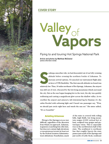
Seeking a smoother ride, we had descended out of our lofty cruising altitude before crossing the northern border of Arkansas. To increase arrival options, I’d canceled our instrument flight plan in favor of VFR flexibility. The first smooth altitude we found was relatively low. Thus, 10 miles northeast of Hot Springs, Arkansas, the airport was still out of view, obscured by the low-lying mountains which surround the city. But as the sun began hanging low in the west, the sky was quickly reddening and casting a magnificent glow across the shallow valley. As we overflew the airport and entered a left downwind leg for Runway 23, the cabin flooded with softening light and I heard one passenger say, “Wow, we should just circle right here and watch the sun set.” His sister added, “It’s so beautiful.”
Aviating Arkansas
Flying to Hot Springs is in no way difficult, regardless of the direction from which you approach. Arkansas, in general, is anything but a flat state, but does not contain high elevations or mountainous terrain (at least not by the Federal Aviation Administra- tion’s definition). Nonetheless, much
of the state is covered with rolling hills, high bluffs, low lying moun- tain ranges (2,000 vertical feet or less), sculpted river gorges and pic- turesque vistas. This is especially true in the northwestern half of the state. The southwest to northeast line that roughly bisects the state passes just south of Hot Springs and just north of Little Rock; southeast
FEBRUARY 2022
KING AIR MAGAZINE • 3
